|
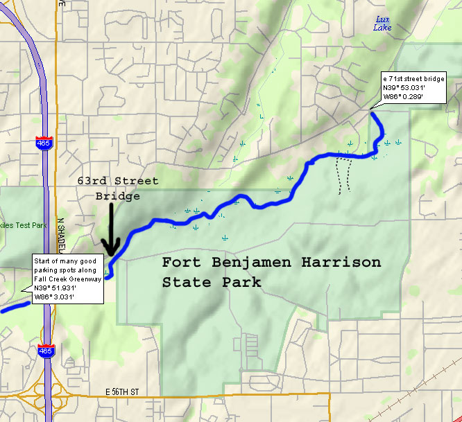
Distance: 3.56 miles
 River
Features: In the first half of this trip the
river continues through Fort Harrison State Park.
In this section wildlife abounds, and personal trips
have awarded sights such as a doe and her fawn taking
a soak in a large deep pool in the river. They,
of course, scrambled out of the river and into the
woods upon sight of canoers rounding the bend. The
park property ends just before the 63rd Street bridge,
where the put-in or take-out is just before to under
the bridge on the right. Shortly after the 63rd
Street bridge you will pass under the bridges for
Shadeland Avenue and I-465. Shortly thereafter you
will find the take-outs for Fall Creek Corridor
Park on the right. River
Features: In the first half of this trip the
river continues through Fort Harrison State Park.
In this section wildlife abounds, and personal trips
have awarded sights such as a doe and her fawn taking
a soak in a large deep pool in the river. They,
of course, scrambled out of the river and into the
woods upon sight of canoers rounding the bend. The
park property ends just before the 63rd Street bridge,
where the put-in or take-out is just before to under
the bridge on the right. Shortly after the 63rd
Street bridge you will pass under the bridges for
Shadeland Avenue and I-465. Shortly thereafter you
will find the take-outs for Fall Creek Corridor
Park on the right.
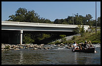
Hazards: At the Shadeland Ave and I-465
bridges is a drop known as "Suicide Falls"
(see photo above). It is the river's most fun and
challenging obstacle (if you dare to attempt it).
|